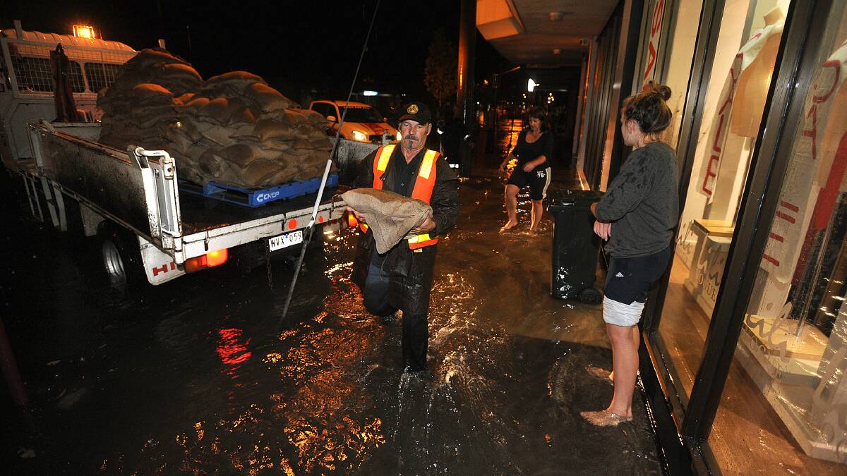
In the summer of 2011, a deluge swept across the Wimmera, resulting in a one-in-200 year flood.
Subscribe now for unlimited access.
or signup to continue reading
Instead of the usually dry heat of summer, Wimmera felt more tropical, as the region was hit with massive rainfall - filling wetlands and lakes overnight and sending an enormous pulse of floodwater down the Wimmera River.
The flooding caused millions of dollars worth of damage to council assets, farmland and property, garnering nationwide attention.
Ten years on from the floods, Wimmera CMA is looking back at the conditions of the season to prepare its flooding and water management better.
READ MORE:
Wimmera CMA Floodplain Management Team Leader Paul Fennell said the group had learnt several lessons about flood management from its work since then.
"We've done a lot of flood studies in that space of time," Mr Fennell said.
"Some of them have been an improvement in existing information, and some of them have been brand new where we didn't have flooding information prior to those events.
"We've used that information in a range of additional spaces around planning for floods in events of emergency management, with Victoria Police, Ambulance Victoria and the like. How we would collectively manage."
Since the 2011 floods Wimmera CMA has conducted case study investigations in Horsham/ Wartook, Natimuk, Upper Wimmera, Mt William, Warracknabeal, Halls Gap and Dunmunkle.
Wimmera CMA has used each case study to produce flood mitigation plans for a range of different flood scenarios.
Mitigation solutions include recently completed upgrades to the Warracknabeal levee and the removal of redundant water storages in Rupanyup.
Mr Fennell said the work completed by the Wimmera CMA since the 2011 floods has strengthened its flood response and mitigation mechanisms.
"Given the impact of the 2011 floods the community has fared very well. The community is very resilient here in the Wimmera," he said.
"This sort of information will no doubt improve our performance in future floods. Hopefully we don't have to use this information in a flood itself but it allows us to be prepared should such a flood come along in the future."
The information has also been used to deliver planning scheme amendments with an understanding of flood risk.
Wimmera CMA offers a free flood advice service for people looking to understand the flood risk of their current or future properties.
The group is also part of a trail for an automated flood alerting system in Natimuk, which will use the VicEmergency app and website.
Did you know you can receive updates straight to your inbox? To make sure you're up-to-date with news from across the region, sign up below.
If you are seeing this message you are a loyal digital subscriber to the Wimmera Mail-Times, as we made this story available only to subscribers. Thank you very much for your support and allowing us to continue telling the Wimmera's story. We appreciate your support of local journalism.
Letter to the editor
Do you have something to say on this issue? Send a Letter to the Editor to newsdesk@mailtimes.com.au

